


Gravity Studio — 3D Geophysics Inversion & Forward Modeling Workstation
Created: August 2026 · Current Release: v2.1.0
Live Production App: gravity-studio.yufajjiru.work
GitHub Repository: github.com/luthfiyufajjiru/gravity-studio
Powered by: Terraversi
An integrated, browser-based geophysics workstation connecting field data acquisition, physical corrections, potential-field calculus, and 3D subsurface voxel forward modeling into a unified computational pipeline.
[!NOTE] Ecosystem Note: Looking for a lightweight, focused tool specifically for extracting global satellite altimetry and seafloor bathymetry grids without 3D forward modeling? Explore TOPEX Interactive (topex-interactive.yufajjiru.work).
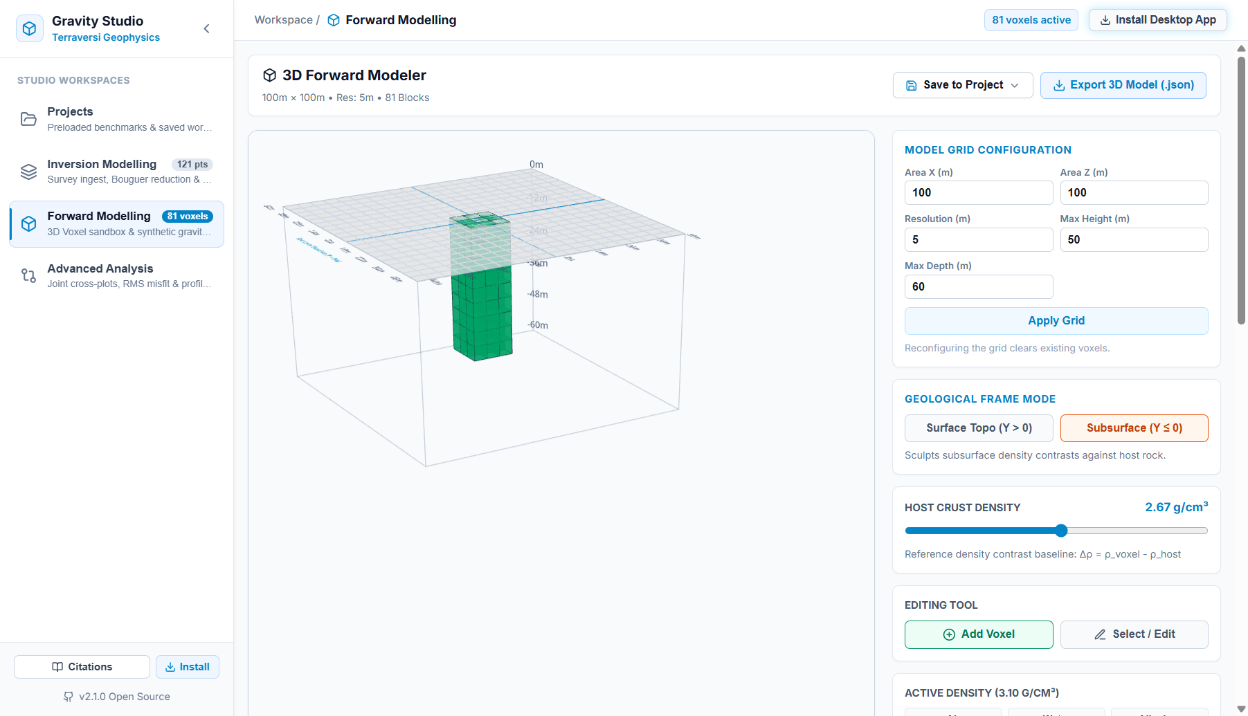
Interactive 3D Voxel Forward Modeler with configurable grid geometry, lithology density palette, and real-time synthetic gravity response:
The Geophysical Workflow
Traditional potential-field geophysics often isolates data reduction, regional filtering, derivative edge detection, and forward modeling across disparate desktop utilities. Gravity Studio bridges these steps into an end-to-end web workbench:
Key Workspaces & Capabilities
1. Multi-Source Survey Ingestion & QC
- Ground & Airborne Land Surveys: Ingests raw tabular gravity readings (CSV, TSV, whitespace-delimited, and Excel
.xlsx/.xyz) with automatic coordinate detection, latitude/longitude conversion, station elevation mapping, and interactive spreadsheet filtering. - Satellite Altimetry Extraction: Ingests global marine and coastal gravity anomaly grids snapped to canonical discrete tiles with edge-cached streaming and zero-meridian wrap.
2. Four-Phase Inversion & Reduction Engine
- Phase 1: Data Gather & Quality Control: Soundings spreadsheet with real-time column sorting, spatial coordinate filtering, and multi-format GIS export.
- Phase 2: Complete Bouguer Reduction:
- Continental () and Marine () Bullard-A reduction:
- 3D Hammer / Hayford-Bowie Terrain Correction: Dynamic search radius () compensating for topography undulation and marine trenches.
- Parasnis & Nettleton Linear Regression: Computes empirical crustal density from the sounding cloud slope ().
- Phase 3: Regional-Residual Field Separation:
- Gaussian low-pass spatial filters (custom cutoff radius ).
- Griffin (1949) moving-average boxcar ring filters.
- 1st-order planar and 2nd-order paraboloid polynomial trend surface fitting to isolate deep Moho trends from shallow structural anomalies.
- Phase 4: 2D Potential Field Calculus & Structural Fault Delineation:
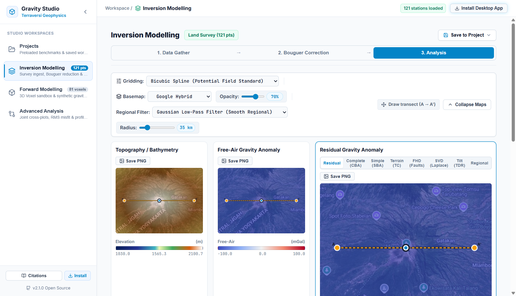
- Tri-Map Synchronized Viewports: Simultaneous rasterization of Topography/Bathymetry, Free-Air Gravity Anomaly, and Complete Bouguer / Residual Anomaly with Bicubic Spline, Thin-Plate Spline, Bilinear, and IDW interpolation.
- First Horizontal Derivative (FHD): Traces lateral density boundary contacts and fault inflections.
- Second Vertical Derivative (SVD via Laplace's Equation): Sharpens shallow basement edges and highlights zero-crossing fault boundaries.
- Tilt Derivative (TDR): Automatic Gain Control (AGC) phase angle filter () equalizing amplitude decay across varying burial depths.
- Elkins (1951) Fault Classification: Automated structural analysis classifying normal, reverse/thrust, and strike-slip fault steps from SVD dipole ratios.
Tri-Map Potential Field analysis viewport over a land gravity survey showing regional filtering and transect line profile:
3. Interactive 3D Voxel Forward Modeler
- WebGL / Three.js 3D Sandbox: Interactive spatial grid with configurable physical bounds (area , resolution, maximum topography height , and subsurface depth ).
- Lithology Density Library: Paint and sculpt voxels using standard rock and fluid densities:
- Air ()
- Water ()
- Alluvium ()
- Sediment ()
- Host Crust Baseline ()
- Granite ()
- Basalt ()
- Gabbro ()
- Massive Sulfide Ore ()
- Real-Time Synthetic Gravity Physics: Background Web Worker evaluates gravitational attraction across all active voxels using analytical rectangular prism integration (Nagy 1966; Plouff 1976), plotting the computed (mGal) profile instantaneously as geometry is modified.
4. Advanced Analysis & Joint Correlation
- Colocated Observation-to-Model Matching: Automatically pairs 2D gridded inversion soundings with colocated 3D forward synthetic responses.
- Observed vs. Calculated Cross-Plot: Visualizes observation alignment along the ideal diagonal.
- Statistical Quality Metrics: Evaluates Pearson correlation coefficient () and Root-Mean-Square (RMS) misfit error with automated geological tuning recommendations.
5. Projects Hub & Preloaded Benchmarks
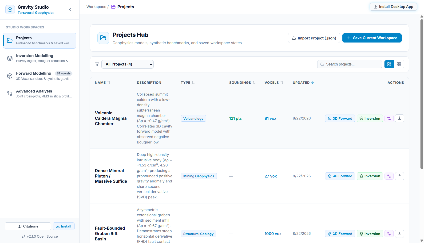
- Volcanic Caldera Magma Chamber: Collapsed summit caldera with low-density subterranean magma chamber (, 121 sounding points, 81 voxels).
- Dense Mineral Pluton / Massive Sulfide: Deep high-density intrusive body (, 27 voxels) producing a sharp SVD peak.
- Fault-Bounded Graben Rift Basin: Asymmetric extensional graben with sediment infill (, 1,000 voxels) demonstrating steep FHD fault contact delineation.
- Subsurface Halite Salt Diapir: Buoyant salt plume (, 121 sounding points, 81 voxels) piercing dense carbonate overburden.
- Workspace Session State: Session persistence with unsaved-changes guard, Gravity Studio
.jsonproject file import/export, and multi-format deliverable exports (Oasis Montaj.XYZ, Surfer.GRD, Geosoft.GXF, GeoTIFF, GeoJSON, composite publication plates).
Projects Hub featuring preloaded benchmarks and workspace state management:
Technical Stack & Architecture
| Layer | Technology |
|---|---|
| Frontend Framework | React 18, TypeScript, Vite, PWA (vite-plugin-pwa) |
| 3D Graphics & Canvas | Three.js, WebGL 2.0, Custom GLSL Fragment Shaders |
| Mapping & Geospatial | Leaflet, Leaflet-Draw, Google Satellite / ESRI Ocean Layers |
| Background Computation | Web Workers (geophysics.worker.ts, forward3d.worker.ts) |
| Edge Backend | Cloudflare Workers, Hono, Cloudflare Cache API |
| State & Navigation | SPA Hash Router with URL stage synchronization (#/inversion?stage=bouguer) |
| Data & Deliverables | Oasis Montaj .XYZ, Surfer .GRD, Geosoft .GXF, GeoTIFF, GeoJSON, CSV, High-DPI PNG Plates |
| Hosting & Deployment | Cloudflare Workers (Custom Domain: gravity-studio.yufajjiru.work) |
Project Links
- Live Production App: https://gravity-studio.yufajjiru.work
- Source Code Repository: https://github.com/luthfiyufajjiru/gravity-studio
- Companion Satellite Altimetry Tool: TOPEX Interactive · Portfolio Overview